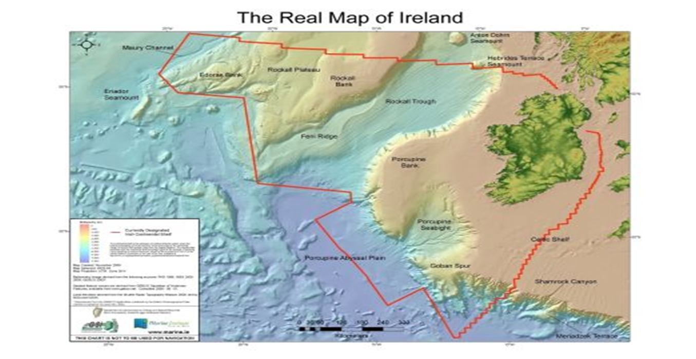
Image courtesy of the Marine Institute
Last week the Irish Whale and Dolphin Group published their Offshore Marine Mammal Atlas, which surveyed Ireland’s seas for whales, dolphins and seals. The Atlas took six years to complete, with researchers spending over 1,000 days at sea recording more than 3,300 sightings of 35,000 animals.
As you can see from the image above, Ireland’s seabed territory extends far into the Atlantic Ocean, but also contains part of the Irish and Celtic Sea, and taken together is called the “Irish Continental Shelf”. The island of Ireland covers 20,863,360 acres of land but can claim a marine and undersea territory over ten times greater than that, at a staggering 220 million acres. The UN Convention of the Law of the Sea grants Ireland the sovereign right to explore this area and to exploit its natural resources.
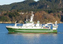
Image courtesy of the Marine Institute
The marine mammal survey took over 5,000 hours of survey effort and was carried out on a variety of vessels, including research vessels (e.g. R.V. Celtic Explorer above), naval vessels (e.g. LE Roisin) and even car ferries (e.g. MV Ulysses). Researchers searched the seas ahead of the vessel by eye and using binoculars, typically on the deck but also on the “monkey island” (i.e. on the roof of the bridge) and the “crow’s nest”. Weather conditions and position data were automatically collected by the ship’s onboard computers and GPS. Continue reading “HABITATS: Atlas of Ireland’s Marine Mammals” →